The city of Cleveland’s vision for potential lakefront improvements west of North Coast Harbor and surrounding a proposed renovation of Cleveland Browns Stadium depends on the funding and construction of the North Coast Connector to link downtown’s core to the shore of Lake Erie, and conversion of the Shoreway highway into a boulevard (JCFO). CLICK IMAGES TO ENLARGE THEM.
Public input will shape final plan, funding applications
A preliminary design for downtown lakefront improvements was unveiled yesterday by the city and its consulting team at the Great Lakes Science Center to advance the project development process. The process would then move into final design, fundraising and environmental permitting so construction could begin possibly in the next two years. But there are some notable differences in the city’s lakefront vision when compared to one commissioned and released two years ago by the owners of the Cleveland Browns football team, The Haslam Group.
The two most significant infrastructure pieces to the city’s lakefront vision is the North Coast Connector and conversion of the Shoreway highway into a boulevard with intersections. The connector is a $200+ million land bridge to link downtown’s landscaped malls with the water’s edge of Lake Erie, dubbed the “Core To The Shore” by Mayor Justin Bibb. It is shown to be more narrow and curving than the concept suggested by Haslams and their consulting team which included Nelson Byrd Woltz Landscape Architects, Osborn Engineering, AoDK Architecture and CallisonRTKL. City planners said curves in the connector will provide constantly changing views of the city and the lake.
Another big infrastructure piece of the city’s lakefront vision is converting the Shoreway from a grade-separated highway to a boulevard with intersections, including ones at West 3rd Street, East 9th Street and possibly a new one at an extended East 18th Street. The latter is intended to divert traffic to/from the East that currently exits at East 9th and to promote more development at the northeast corner of downtown. There are no publicly available cost estimates yet for the Shoreway conversion.
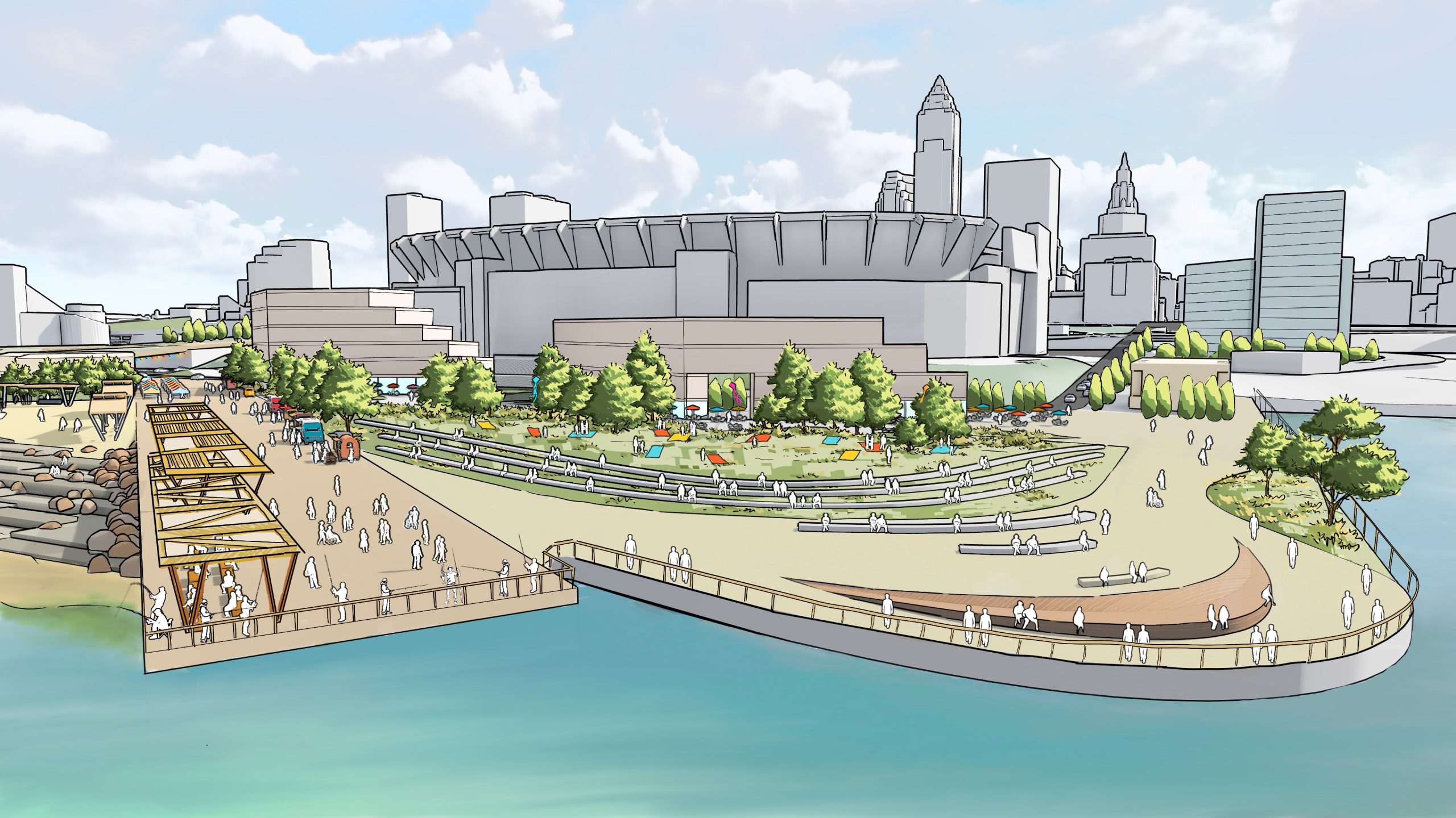
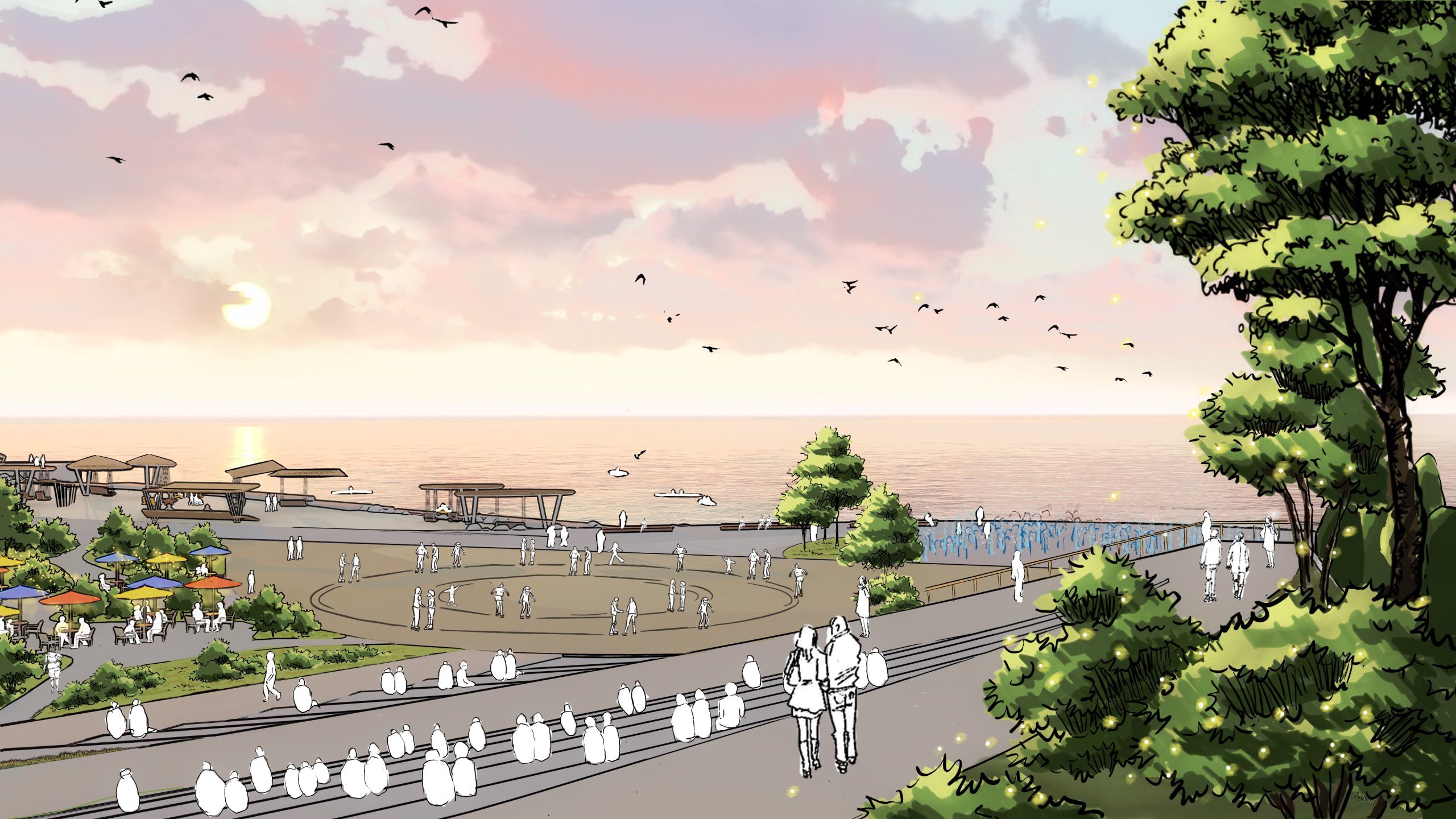
A fishing pier at left and, to its right, a lawn to watch shipping activity at the Port of Cleveland are among the features proposed to be included in the city’s lakefront plan. In the background is Cleveland Browns Stadium and, to the right of it, a new ferry terminal and potential high-rise development along West 3rd Street (JCFO).
One question that was answered by the city’s newly released plan was how the new boulevard would interact with West 3rd. In the alternatives analysis, of which this draft plan represents the near-culmination, one option was to have the boulevard share a widened West 3rd bridge across the railroad tracks. But the city’s plan shows the boulevard snaking over the tracks on its own, new bridge to rejoin with the existing Main Avenue Bridge over the Cuyahoga River and the Flats.
The city’s vision shows another significant difference from the Haslam plan — fewer buildings and more public spaces, especially north of the football stadium. The Haslam plan showed numerous low-rise residential buildings north of the stadium, which is in Burke Lakefront Airport’s flight path and four high-rise buildings south and east of the stadium along the railroad tracks and new boulevard.
In the city’s plan, those high-rise buildings are not shown near the railroad tracks and new boulevard. That part of the visionary renderings is left blank, as is the renovation of the stadium which is shown as a largely featureless box. Those are considered separate projects for the purposes of this plan, said planners at New York City-based James Corner Field Operations who are working with the city.
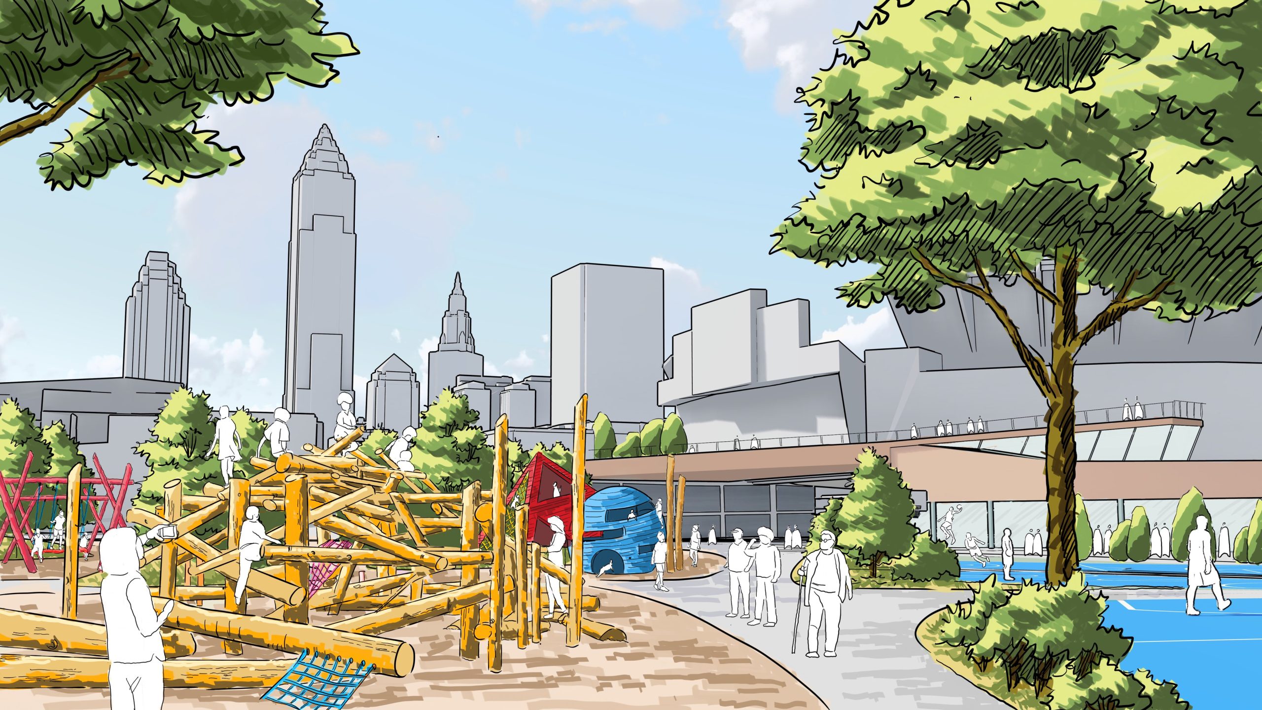
Part of a future playground at the north end of the proposed North Coast Connector, seen at right. The types of features shown in the playground could change based on public input and available funding (JCFO).
According to a team source, the scale of development was reportedly sought to provide a value-capture revenue stream to help Browns owners Jimmy and Dee Haslam provide a larger private sector contribution to the renovation of the city’s stadium. The city and the Haslam Group are negotiating over the future of the stadium including how to finance its renovation which could cost up to $1 billion. But the talks reportedly have hit an impasse.
Near the start of yesterday’s presentation of the city’s proposed lakefront plans, Mayor Bibb talked about his expectations and goals for the lakefront plan. Much of that was shaped by his experiences in growing up in a black neighborhood on the southeast side of the city. He said he had never visited the lakefront until he was in high school.
“The lakefront was seen as a place for rich, white folks,” he said. “This (lakefront) plan wasn’t formed in a board room. It was formed with input of the people who would use it. Cleveland is one of the most segregated cities in the country. The river and the lake were part of that as dividing lines. We’re proposing a lakefront that is a place of healing.”
Looking a lot like the Solstice Steps in Lakewood, the north end of the North Coast Connector would both step down and have a Z-shaped ramp for disabled access-compliance and for bicycles. But cyclists at yesterday’s meeting said the sharp turns in the ramp would be difficult and possibly dangerous (JCFO).
Other features of note in the city’s lakefront vision is the undulating land added north of the stadium to break up the wind off the lake. North of that is a proposed beach. That would require digging out some of the century-old garbage landfill on which the stadium, and the Cleveland Municipal Stadium before it, were built to create a gentle slope into the water. North of that, the water would suddenly get deep as the harbor is dredged to a draft of 27 feet for large ships.
Ward 13 Councilman Kristopher Harsh said he questioned how clean the water would be at the beach considering it’s inside the protective breakwall and the water doesn’t move as much there. He also questioned whether such a narrow North Coast Coast connector justified downgrading the Shoreway into a boulevard. Planners said the Shoreway’s rising bridge, over West 3rd and and the railroad tracks, is in the way of the connector and creates a physical and psychological barrier for pedestrians between downtown and the lakefront.
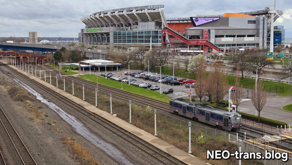
In addition to the new boulevard, the lakefront plan has other transportation features including a new multimodal transportation center below the land bridge to provide a combined station for Amtrak and Greater Cleveland Regional Transit Authority trains. The Waterfront Line stations at East 9th and West 3rd would be removed. The transportation center was supported by Stu Nicholson, executive director of the rail and transit association All Aboard Ohio. Also in the plan is a cruise ship terminal at the foot of West 3rd. The Port of Cleveland said it will handle 49 port calls by cruise ships this season, up from 37 in 2022.
END