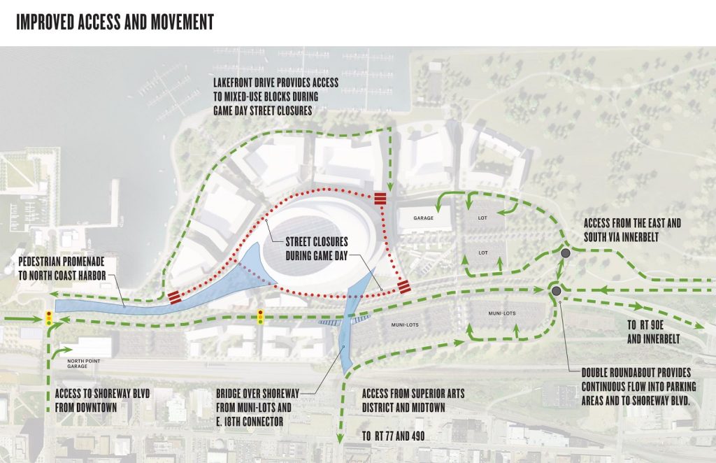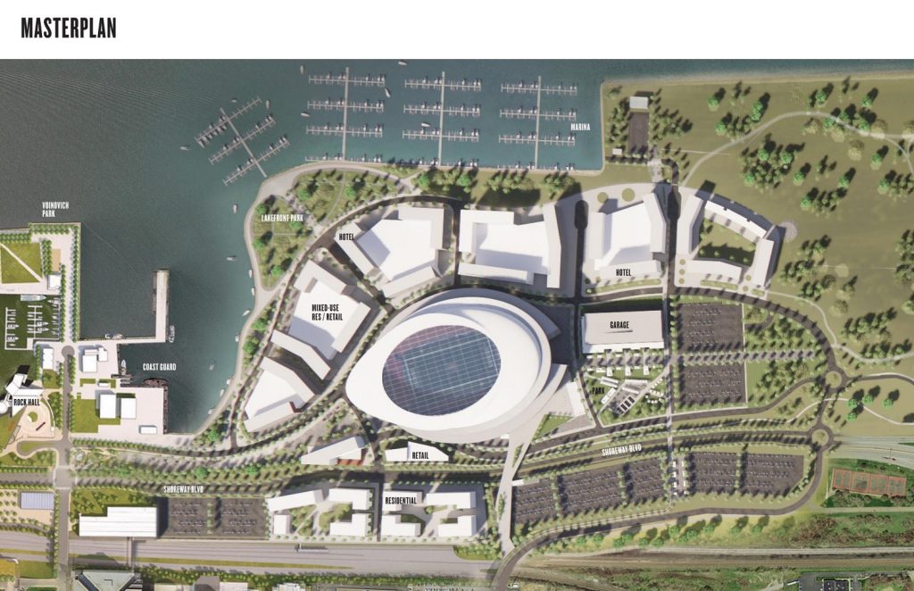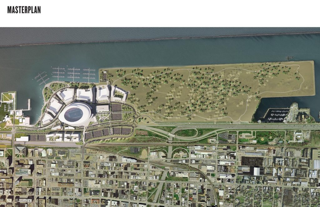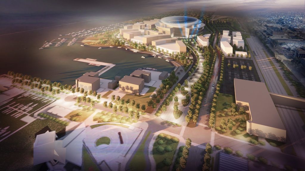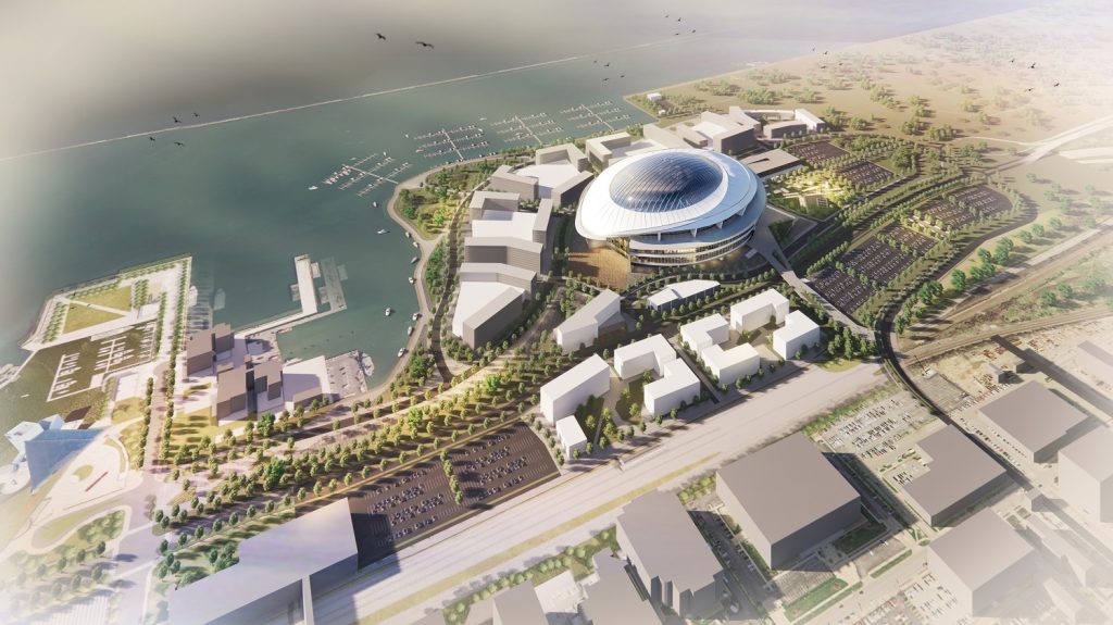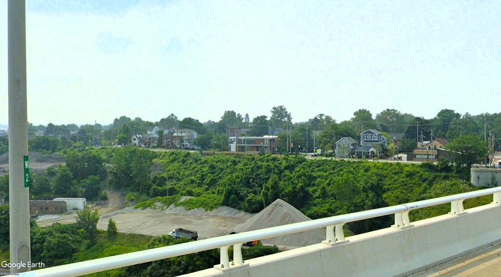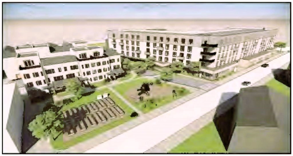
Conceptual renderings of what a domed stadium built at Burke Lakefront Airport in Downtown Cleveland could look like were anonymously sent to NEOtrans today. We published them as soon as we could verify their authenticity with an official sponsor, This view shows a stadium placed where the airport’s terminal is currently located (Vocon). CLICK IMAGES TO ENLARGE THEM.
Renderings sent to NEOtrans, other media

NEOtrans was among the Greater Cleveland media outlets to anonymously receive renderings of what a Cleveland Browns domed stadium at Burke Lakefront Airport could look like. The renderings, which also show stadium-area development, changes to roadways and parking, were commissioned from Cleveland-based architecture firm Vocon Partners LLC by the convention and tourism bureau Destination Cleveland.
Destination Cleveland’s Vice President of Public Relations and Communications Emily Lauer confirmed to NEOtrans that the renderings are legitimate. NEOtrans received the images this morning but waited to publish the graphics until it heard from an official, on-the-record source.
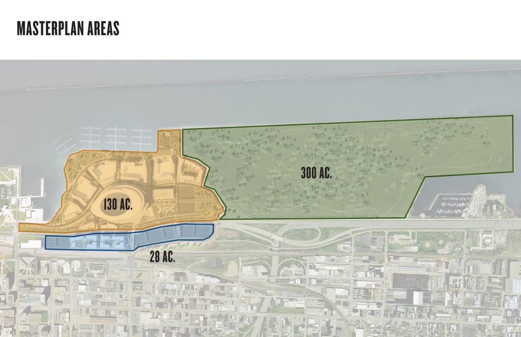
Burke Lakefront Airport and its surroundings were broken up into three separate planning areas including 130 acres of airport grounds to be developed, 28 acres of Municipal Parking Lots to be developed or improved and about 300 acres of airport and confined disposal facilities of river and harbor dredgings to become recreational parkland and wildlife sanctuaries (Vocon).
“In anticipation of requests for support regarding the future home of the Cleveland Browns, Destination Cleveland’s Board of Directors voted to remain neutral,” Lauer said in a written statement. “No matter where the team plays, the organization’s job is to promote the Cleveland football experience. The board also concluded that the only way Destination Cleveland could provide value to the negotiations would be – if needed – to conduct research to inform decision making.”
An anonymous source notified NEOtrans via a secure e-mail server last week that the renderings would be sent over the weekend. The source’s initial contact was unsolicited. Some very-low-resolution images were sent as samples. The detailed images didn’t arrive until this morning.
“Given the unanswered questions about the viability of Burke Lakefront Airport as a development site, Destination Cleveland engaged relevant partners to specifically determine if the airport land could accommodate the program the Browns had proposed in Brook Park. The city and county were informed of the project at its onset,” Lauer added.
NEOtrans reached out to City Planning Commission officials for comment but have yet to hear back from them or other city spokespersons.
“Upon completion, the study was released only to the city and county, with the understanding that they would decide whether to provide the information to Haslam Sports Group,” Lauer added. “The study has not been provided by Destination Cleveland to any entities or individuals other than the city and county.”
In February, NEOtrans broke the story that the Cleveland Browns were in the process of purchasing 176 acres of land in suburban Brook Park for a new stadium and supportive development. We also were the first to share a rendering of that proposed stadium.
In August, we broke the story that Cleveland had offered to close and repurpose Burke Lakefront Airport to avail an even larger potential development site than the one in Brook Park. The Burke Lakefront Airport site is supported by Mayor Justin Bibb, Cuyahoga County Executive Chris Ronayne and other public officials.
“I don’t think this is over yet,” Ronayne told NEOtrans in a phone interview. “I don’t think the city (of Cleveland) is out of it.”
But the Haslam Sports Group said it would take too long to improve other airports like Cuyahoga County Airport to take up Burke’s slack, close Burke and develop it for the new stadium. To close Burke would take up to 12 years and cost tens of millions of dollars, according to a study released by the city in September.
“Our most impactful investment for our region is to focus on making a dome stadium and adjacent development in Brook Park a reality,” said Cleveland Browns owners Jimmy and Dee Haslam in a recent press release.
Waiting for Burke to be ready for redevelopment would also likely require making interim repairs to the existing stadium, Huntington Bank Field. An October 2023 stadium audit by Osborne Engineering said the stadium’s building systems will need $117 million in capital repairs over the next 10 years. The Browns’ lease at the stadium ends after the 2028 football season.
“They (Haslams) have a sense of urgency,” said Cleveland City Council President Blaine Griffin when asked about Burke versus Brook Park. “They want a decision fast. They do not want to wait and prolong a decision.”
END

