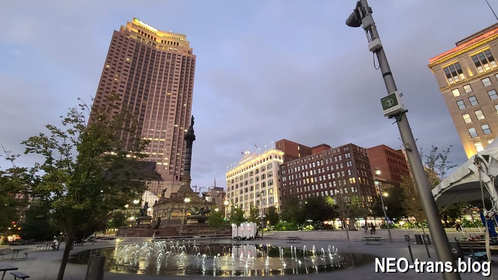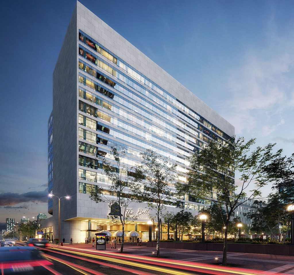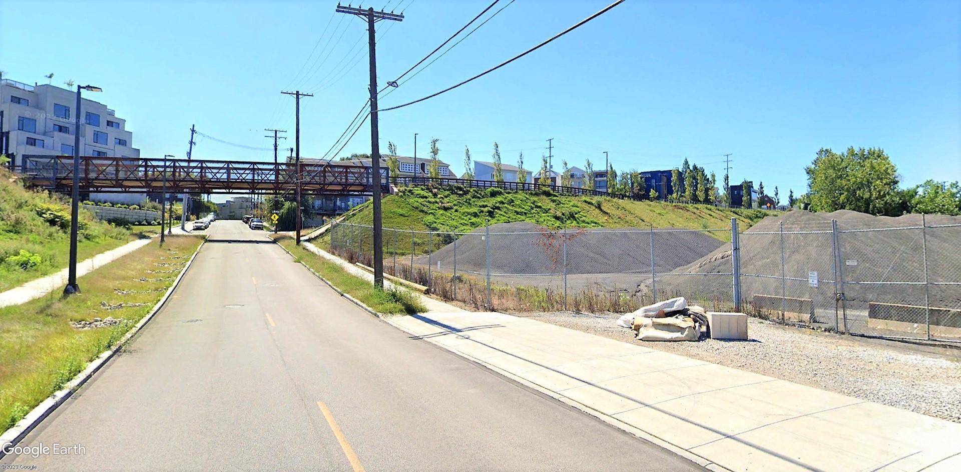
The western edge of a nearly 25-acre site, at right, that’s proposed to be down-zoned from industrial to retail in Cleveland is seen at the bottom of Literary Street hill. This is also the edge of residential development in Tremont, visible just beyond the Towpath Trail’s bridge. At left is the Electric Gardens apartments developed by J Roc which is seeking the zoning change (Google). CLICK IMAGES TO ENLARGE THEM.
Rezoning OK’d despite opposition by industry
A nearly 25-acre area of land on a hillside at the north end of Tremont was recommended for rezoning by the City Planning Commission yesterday to allow more development closer to the Cuyahoga River. But the rezoning, primarily from general industry to general retail to accommodate new residential, neighborhood shops and restaurants, was opposed by the industries currently using those properties. Planning commission members responded that the rezoning allows existing uses to continue and that the rezoning is consistent with the city’s land use plans, namely its Vision For The Valley.
The property in which active local real estate developer J Roc Development LLC is most interested, a 17.9-acre parcel owned by Emerald Dock Inc., is the subject of a civil lawsuit filed in November 2022 in Cuyahoga County Common Pleas Court. The lawsuit was filed after Holcim Quarries NY Inc., based in Chicago, and successor to Lafarge which uses the affected property for materials storage as part of the asphalt plant, learned that Penta Holdings LLC of Florida acquired ownership interest in Emerald Dock from River West Dock Inc.
Holcim claimed that was in violation of a lease that began in 1995, amended in 2001 to include land owned by River West, and assigned in 2003 to S.E. Johnson Companies Inc. which merged that year with The Shelly Co. Then, Penta sold its ownership interest in Emerald Dock to J Roc. That included interest in the Emerald Dock property that is subject to the rezoning.
Holcim claims that those acquisitions by Penta and J Roc violated the amended and reassigned 1995 lease that is due to expire in July 2023 which gave Lafarge, and by successor rights Holcim, a right of first refusal to buy the property Emerald Dock acquired from River West. That is despite S.E. Johnson’s transferring ownership to Shelly and, in 2015, Lafarge and Holcim merging and issuing new Holcim shares to Lafarge shareholders. Holcim and Shelly claim their ownership transfers did not violate the lease terms. But J Roc reportedly claims it didn’t violate the lease terms either because it didn’t buy land; instead it bought the company that owned the land and could choose to extend, amend or terminate leases it acquired.
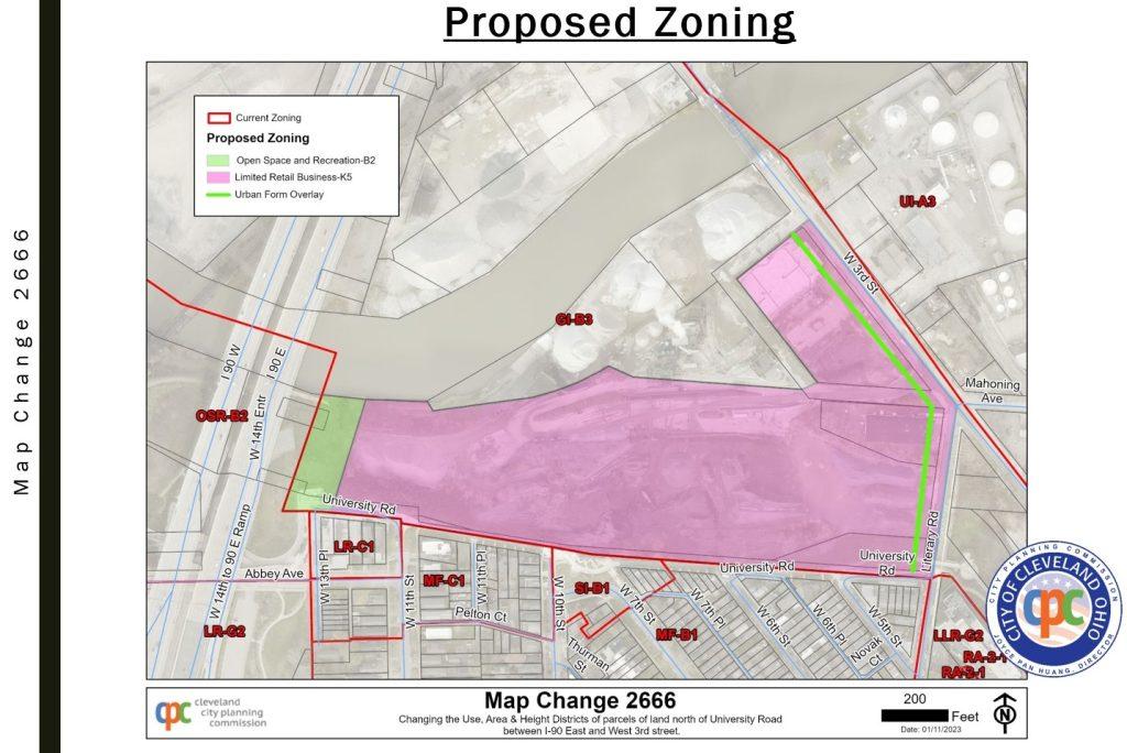
The green and pink areas on this map show the parcels to be rezoned, along with a short stretch of Mahoning Avenue. The green portion at left would correct a split-zoning of a single parcel among two different use categories. University Road has been partially converted into the Towpath Trail (CPC).
“We support the planning department’s (zoning) change,” said J Roc Principal Aaron Taylor, addressing the planning commission as a representative of Emerald Dock. “We are in support of what they feel is best for the site.”
For much of the 19th and 20th centuries, the property was the Literary Street Yards, a railroad interchange yard owned and operated by the Erie Railroad. It was abandoned by a successor, the Consolidated Rail Corp. in 1981. Neighboring parcels closer to the river were historically used by Sherwin-Williams for a linseed oil plant and by a Cleveland Builders Supply warehouse. It became Asphalt Plant 76, 2214 W. 3rd St., soon thereafter.
“This is the largest asphalt plant in state,” said Chad Reel, vice president and general manager of Shelly. “It operates 24 hours a day. We supply upwards of 80,000 tons of asphalt to the city of Cleveland. We would lose $1 million per year if this plant shut. There’s no plan to cease to exist. We strongly ask that you not pass this zoning change. At a minimum, we ask that you wait until we understand who the ownership is at the end of our lease term.”
But City Planning Commission Commission members disagreed and supported the rezoning with one member, Ericka Anthony, voting no because she wanted to table it. The matter now goes to City Council which tends to support rezonings based on the views of the councilperson who represents the ward in which the rezoning is located. Ward 3 Councilman Kerry McCormack said he supports the rezoning, especially after a request to increase the site’s height limit to 250 feet was removed from the proposed zoning map change. The current height limit is 115 feet which would allow buildings roughly 11 stories tall.
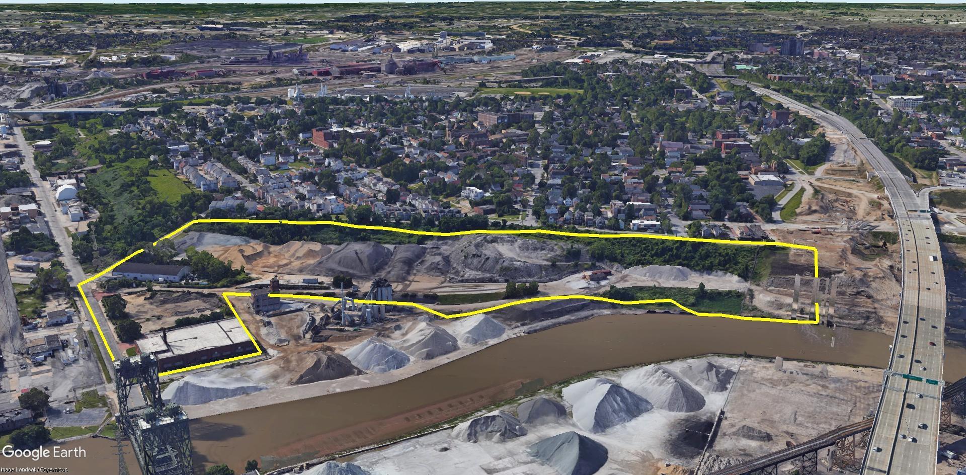
Outlined in yellow is a nearly 25-acre site to be rezoned primarily to allow for the development of housing, neighborhood retail, and restaurants. But a small portion at far right, next to the Inner Belt bridge, would be rezoned as open space/recreation to be consistent with the zoning on the rest of the parcel below the bridge. The land between the rezoning site and the river is owned by Lafarge (Google).
“The neighborhood didn’t want to see a height increase so the city removed it,” McCormack said, referring to input provided at a North Of Literary Block Club meeting held Wednesday and attended by about 50 residents. “They asked how it (rezoning) relates to the Towpath (Trail) and the surrounding neighborhood. There’s no development plan for site yet. This is a forward-looking rezoning of the property and the neighborhood was in support of changing the use, just not of increasing the height.”
“If we’re serious about the Vision for the Valley the idea of zoning for it makes a lot of sense,” said City Planning Commission Chair Lillian Kuri. “I hear the concerns, but this is a downzoning that is more protective for the community. It would also add a more connected riverfront access that can be controlled and does not prevent the existing use from remaining because it would be grandfathered in.”
But not everyone agreed that the neighborhood supported the rezoning or that it should proceed right now.
“This (rezoning) has not gone through the full community engagement process at Tremont West Development Corp. (TWDC) including its economic development committee,” said Donna Grigonis, TWDC’s director of real estate and economic development. “Nothing was voted on (at the block club meeting) but the majority was not positive. People were very concerned about the (250-foot) height.”
“I spoke with the chair of block club after the meeting,” Taylor said. “His sentiment was contradictory to what Donna and the residents said that there was opposition.”
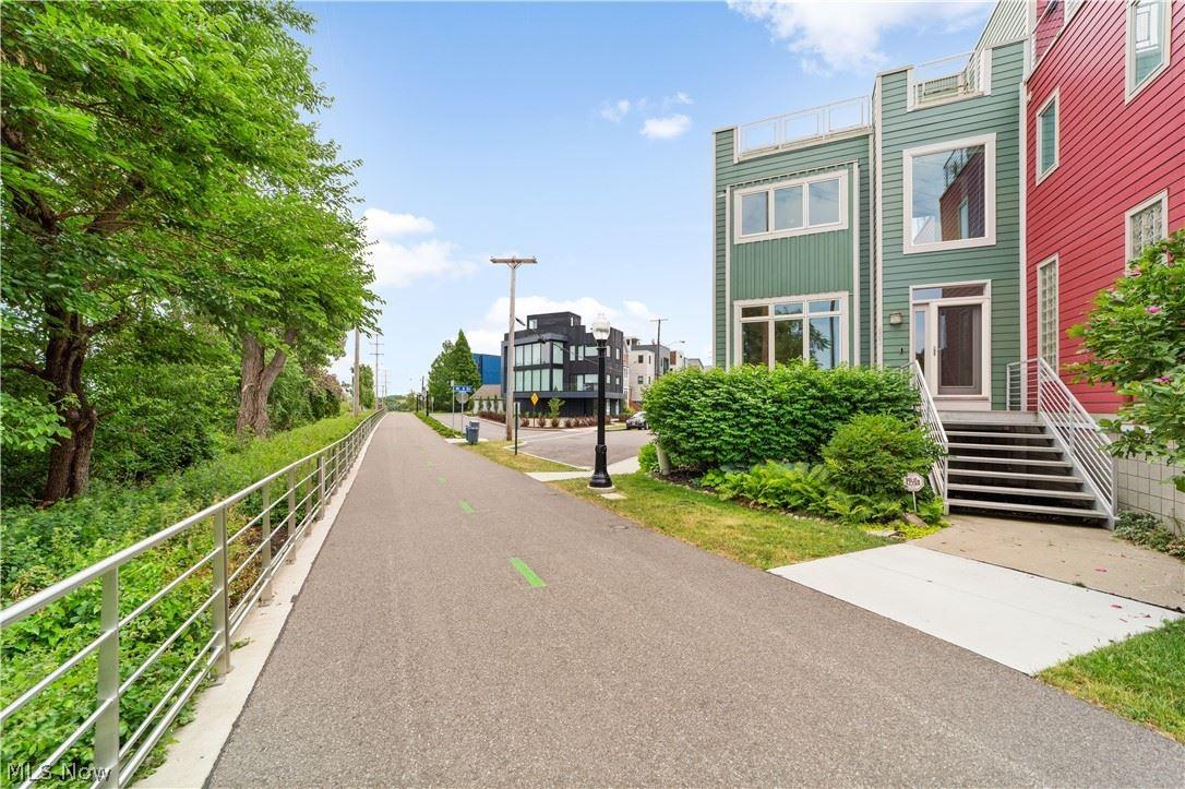
Much of University Road in Tremont, just above and the south of the J Roc-Emerald Dock development site, was converted in 2020 into the Towpath Trail. Nearby are townhomes that have sold in the past year for from $555,000 to $1.1 million (Howard Hanna).
Several residents living along University Road disputed McCormack’s assertion that the community was generally supportive of the rezoning. They said development of the land north of University would adversely affect their property values by adding noise, traffic and casting shadows from 11-story buildings across their homes — even though the development site is north of their properties and the sun is to the south. Also the land immediately north of University is 25-60 feet lower, and land closer to the river is 75-100 feet lower, according to GoogleEarth maps in terrain mode.
“With the site and the slope of that nature, it would be from an engineering standpoint challenging to say the least to build something right up next to the Towpath Trail,” Taylor said. “As developers, just again there’s no plan here, but you can look at our project next door (Electric Gardens) and see our relationship to the Towpath and how we welcome that and enhance that as opposed to inhibiting the flow or the community aspect of that.”
The rezoning extended through another property, a 1.16-acre lot at 360 Literary owned by the Zemaitis family and used by Northern Chemical Blending Corp., to reach a city-owned parcel at 2200 W. 3rd. St. It is a 3.104-acre parcel with an 88-year-old, two-story brick building once used by the city’s Division of Motor Vehicle Maintenance. The parcel also has an address of 260 Mahoning Ave. which is not a passable street; its right of way is partially included in the rezoning.
“That is an asset the city owns that was identified through a program initiated by the (Mayor Justin Bibb) administration called Putting Assets To Work,” said city planner Matt Moss. “That was a city-owned parcel that was identified as being viable for reuse. It is the confluence of these positions the (Vision For The) Valley plan, the change of ownership of land, identifying the assets that we own and can be reutilized for higher and better use or to provide more resources for the city are why we’re here today.”
END