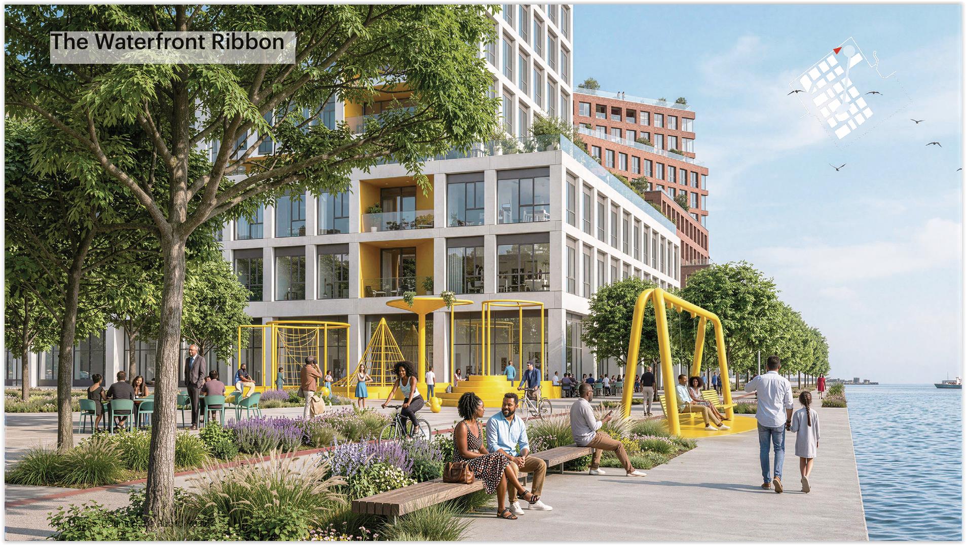
Proposed to be built along the water’s edge north of where the Huntington Bank Field now stands is this continuous boardwalk, park and vertical the development. The taller development is located at the west end of the site, farthest from Burke Lakefront Airport so if the airport remains, these structures can be built (MVRDV-DLR Group). CLICK IMAGES TO ENLARGE THEM.
Plans released for what follows roadwork
Today, the City of Cleveland released updated, post-stadium lakefront plans. On Wednesday, the city is hosting a pre-bid meeting where construction companies and other potential vendors can get information on building the first big pieces of the lakefront’s redevelopment.
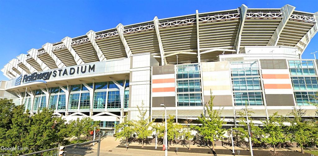
The plans released today show what would be built before and after the 1999-built Huntington Bank Field is demolished by 2032 in favor of a new, covered Huntington Bank Field now under construction in suburban Brook Park.
Some of the construction — the Shoreway’s conversion to a boulevard, a pedestrian bridge over the lakefront tracks and boulevard, and development of a Lake Erie Plaza north of the Great Lakes Science Center — is on schedule to start before the stadium comes down.
At 9 a.m. Wednesday, the Mayors Office of Capital Projects is hosting a pre-bid meeting at the Huntington Convention Center of Cleveland for potential vendors seeking to build the first phase of lakefront construction, totaling about $285 million. Construction could start by the end of next year.
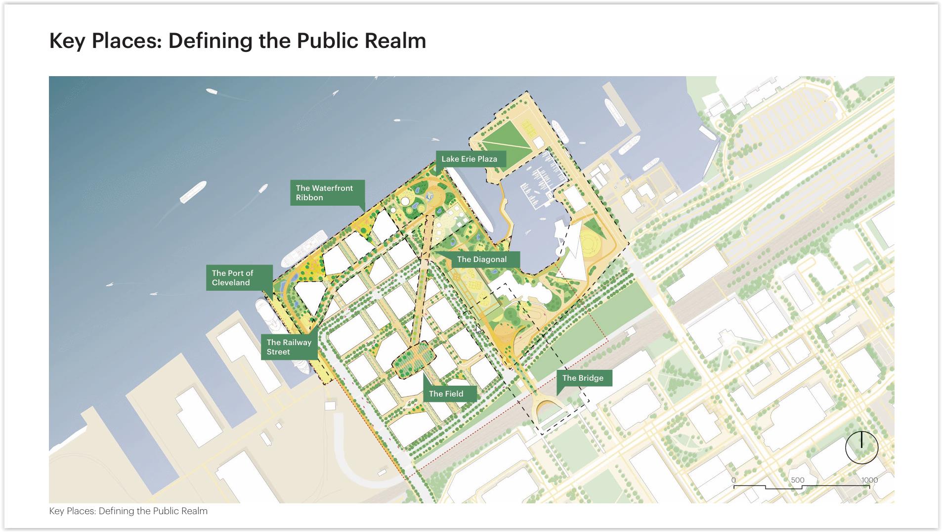
Conceptual framework for the infrastructure needed to make the Downtown Cleveland lakefront redevelopment happen, with this image focusing on public spaces including streets, parks, boardwalks and “The Field” which is the location of the current playing surface of Huntington Bank Field (MVRDV-DLR Group).
“Phase One refers to the first construction package, which includes the Shoreway conversion from approximately West 9th Street to (1,000 feet) east of East 9th Street, and associated infrastructure improvements, including the land bridge,” the pre-bid meeting invitation notes. “Phase two will run from east of East 9th Street to the Innerbelt Curve and will advance once the city obtains construction funding.”
The Haslam Sports Group agreed one year ago agreed to settle legal disputes with the city over the Browns’ departure. The settlement funds the stadium’s demolition at a cost of about $30 million and contributes another $70 million in community benefits projects, with much of that going to lakefront redevelopment.
“With the $100 million stadium settlement and over $150 million in federal and state grants, we have the resources to make meaningful progress — connecting people to the water, creating economic opportunity for residents, and reshaping Cleveland as a true waterfront city that supports downtown businesses year-round, not just a few days a year.” said Cleveland Mayor Justin Bibb in a written statement.
Replacing the stadium structurally is hard. Replacing it in terms of new activity is not. According to the Institute of Transportation Engineers, it would take anywhere from 172 to 362 new housing units on the lakefront to equal the number of trips per year that the stadium generates annually.
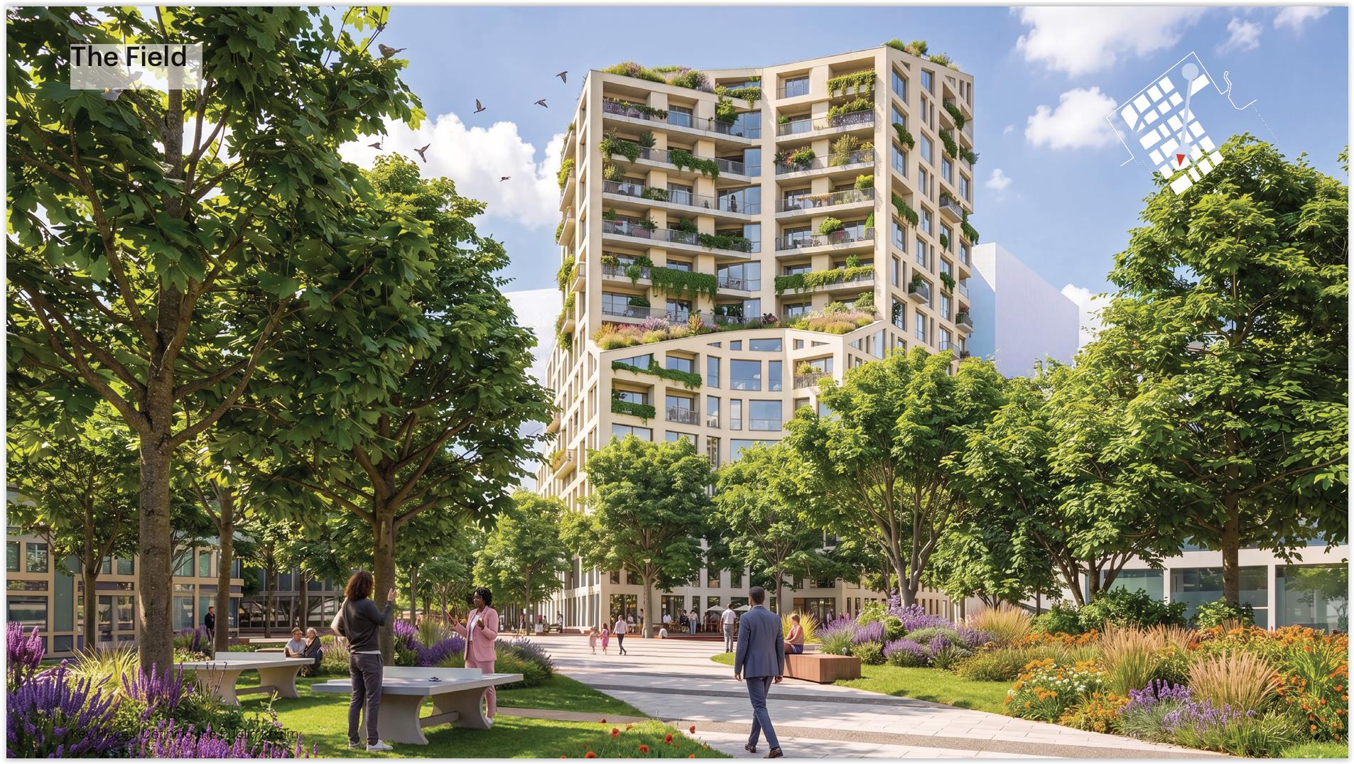
At ground level, this is what The Field could look like. This is where the current playing surface of Huntington Bank Field is today, looking generally southward (MVRDV-DLR Group).
That post-stadium future includes a new Shoreway boulevard, land bridge, multimodal transportation center, street grid, parks, public spaces, boardwalks, and concepts for buildings that would populate the site based on the real estate market, according to the framework released today.
Everything except the buildings would be constructed by the city and its public-sector partners. For the buildings, DiGeronimo Development of Brecksville was selected in December 2025 as the city’s lakefront master developer.
Local, state and federal funding is in hand for the city to begin work next year on the Shoreway’s conversion to a boulevard and the land bridge over the railroad tracks and boulevard, noted Scott Skinner, executive director of the North Coast Waterfront Development Corp. (NCWDC).
NCWDC is responsible for administering the city’s funding and developer coordination for building out the 25 acres of land north of Huntington Bank Field and for the 25-acre footprint of Huntington Bank Field, post-demolition.
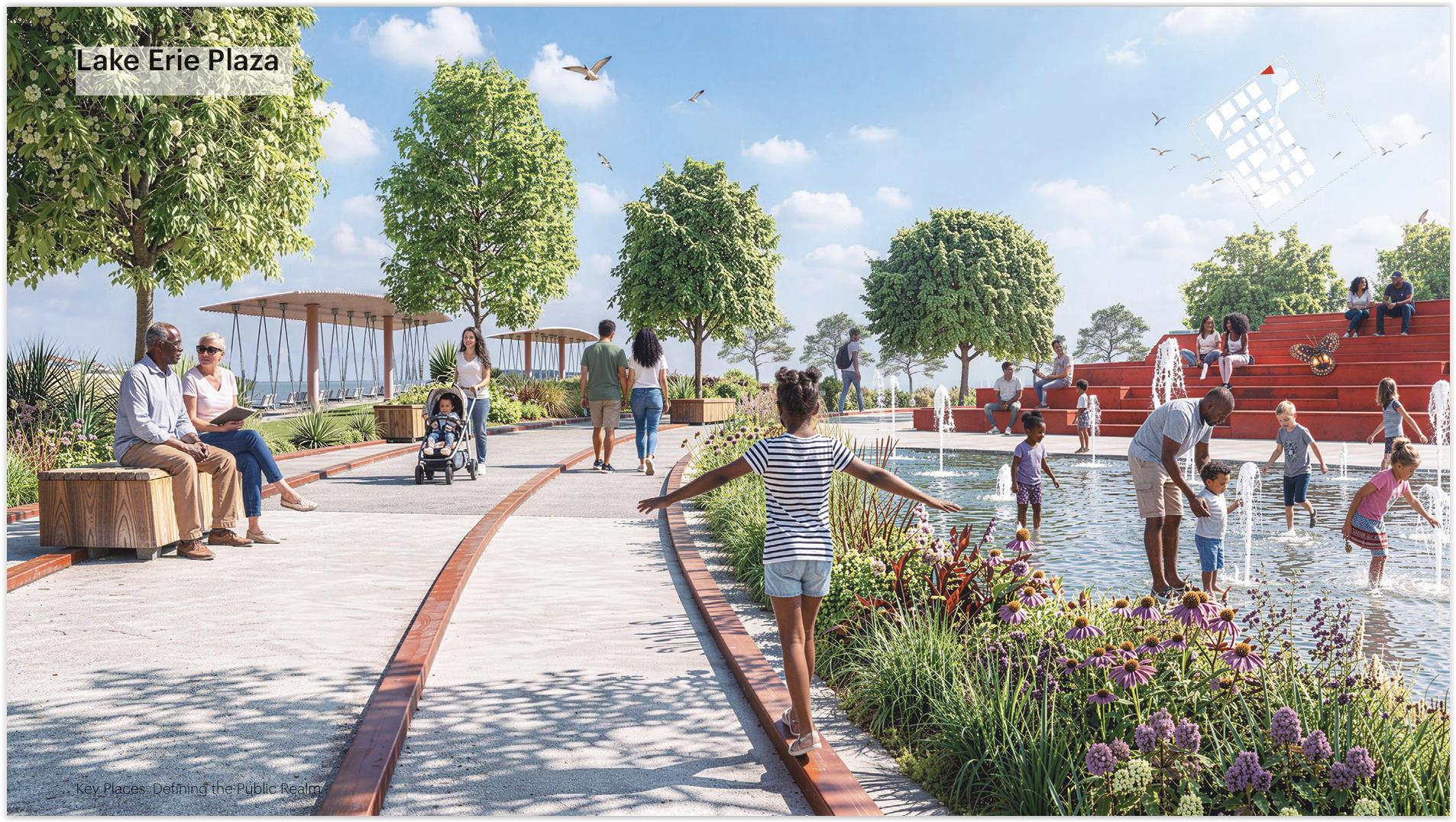
One of the first features that could be built, even before the stadium is demolished, is this park at the northeast corner of the lakefront district. This is where the current pop-up park, the North Coast Yard, is currently located (MVRDV-DLR Group).
“Over the past two years, NCWDC has worked with the City to secure $150 million in state and federal grants for the North Coast Connector, established Cleveland’s first New Community Authority, selected a master developer for the stadium site and opened North Coast Yard, which has welcomed more than 75,000 unique visitors during its first two summers,” he wrote in a letter to Bibb and City Council.
“Developed in partnership with DiGeronimo Development and with input from the City’s Planning Department, the framework builds on previous City planning and extensive community engagement while responding to new opportunities created by the planned departure of the Cleveland Browns,” he added.
A 2024 city lakefront masterplan by the New York City-based firm Field Operations included the stadium when it wasn’t yet certain if the Browns, with its nine to 10 home games per season (plus a few concerts per year) and thousands of parking spaces, would relocate from the shores of Lake Erie.
With that move a done deal, the city commissioned MVRDV of Rotterdam, Netherlands and DLR Group of Cleveland to address how to repurpose the 50 acres of land on which the city-owned stadium and seldom-used waterfront parking lots now set.
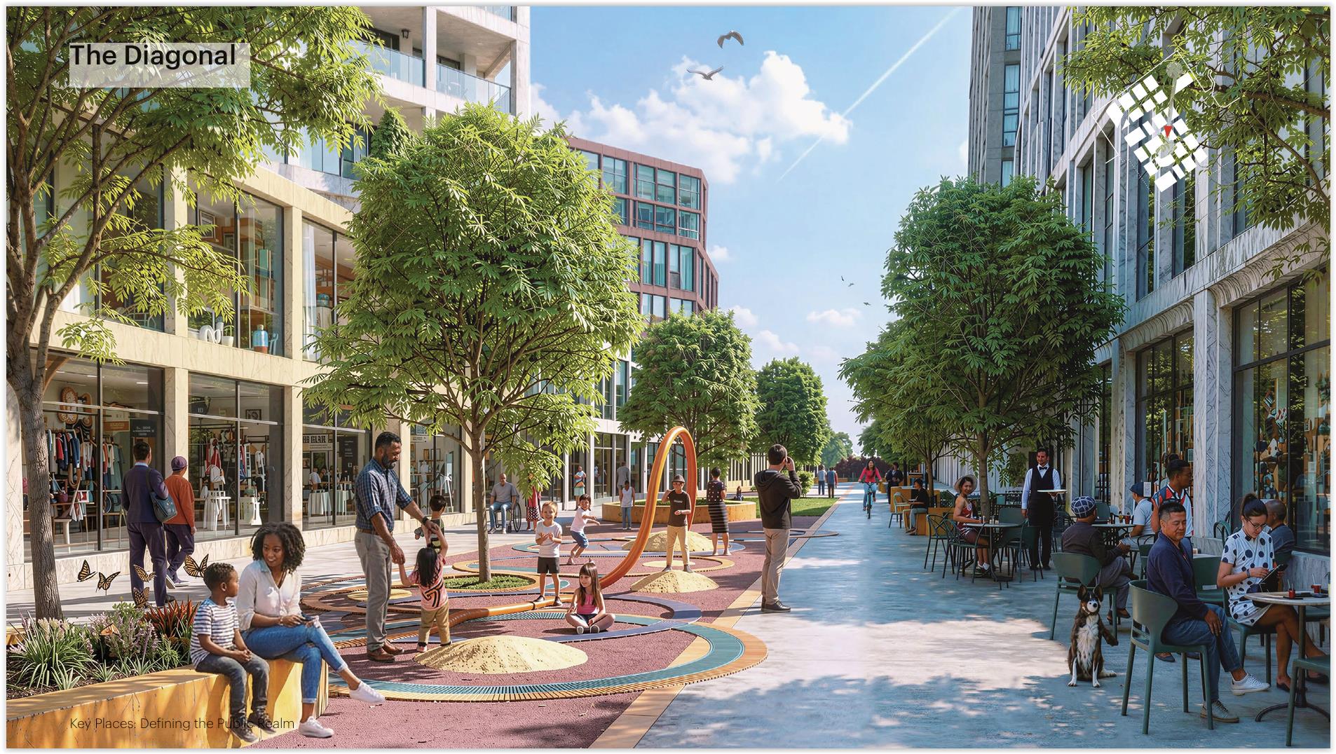
Looking generally north along a planned diagonal pedestrian pathway through the new lakefront district, the concept shows that streets can be a destination for people too (MVRDV-DLR Group).
“The framework envisions a continuous waterfront promenade; a major gathering space connecting the Great Lakes Science Center, Rock & Roll Hall of Fame and North Coast Harbor; and a central park incorporating the footprint of the current stadium playing field,” the masterplan’s summary noted.
“Pedestrian pathways, including a proposed quarter-mile diagonal promenade, would connect these destinations, complemented by smaller public spaces throughout the district,” the plan’s summary continues.
The city is also seeking to name by Dec. 31 a consultant to establish its Shore to Core to Shore tax-increment financing (TIF) structures and strategies to help fund public infrastructure — streets, sewers, parks, boardwalks and other public spaces. A request for qualifications was issued by the city in August.
The Shore to Core to Shore TIF is Mayor Bibb’s council-approved mechanism to capture the new taxes generated by new commercial activities generated by $955 million in potential public infrastructure investments on the lakefront, downtown and riverfront.
END